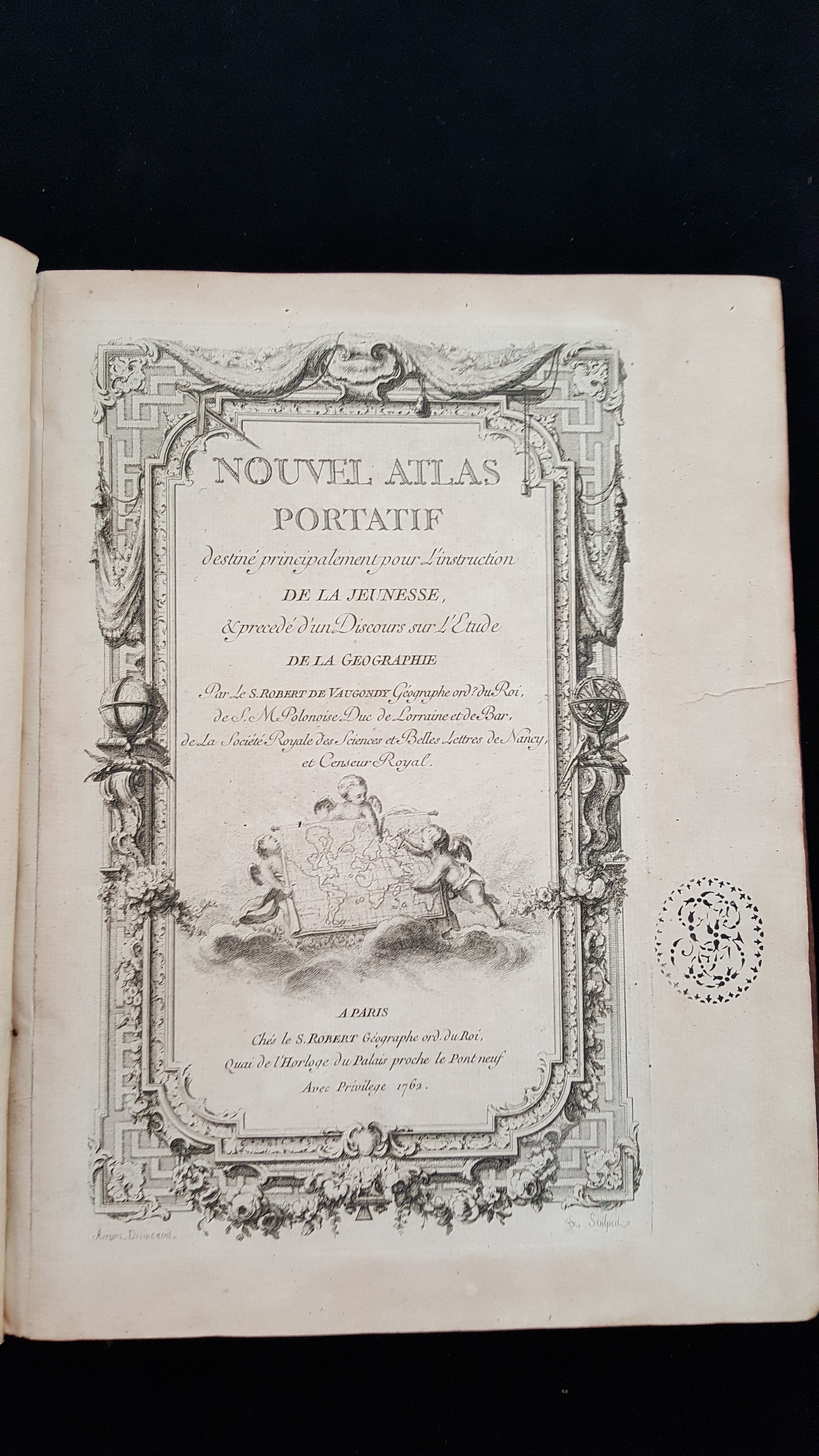
Nouvel Atlas Portatif

Nouvel atlas portatif : destiné principalement pour l'instruction de la jeunesse, & precedé d'un discours sur l'etude de la geographie
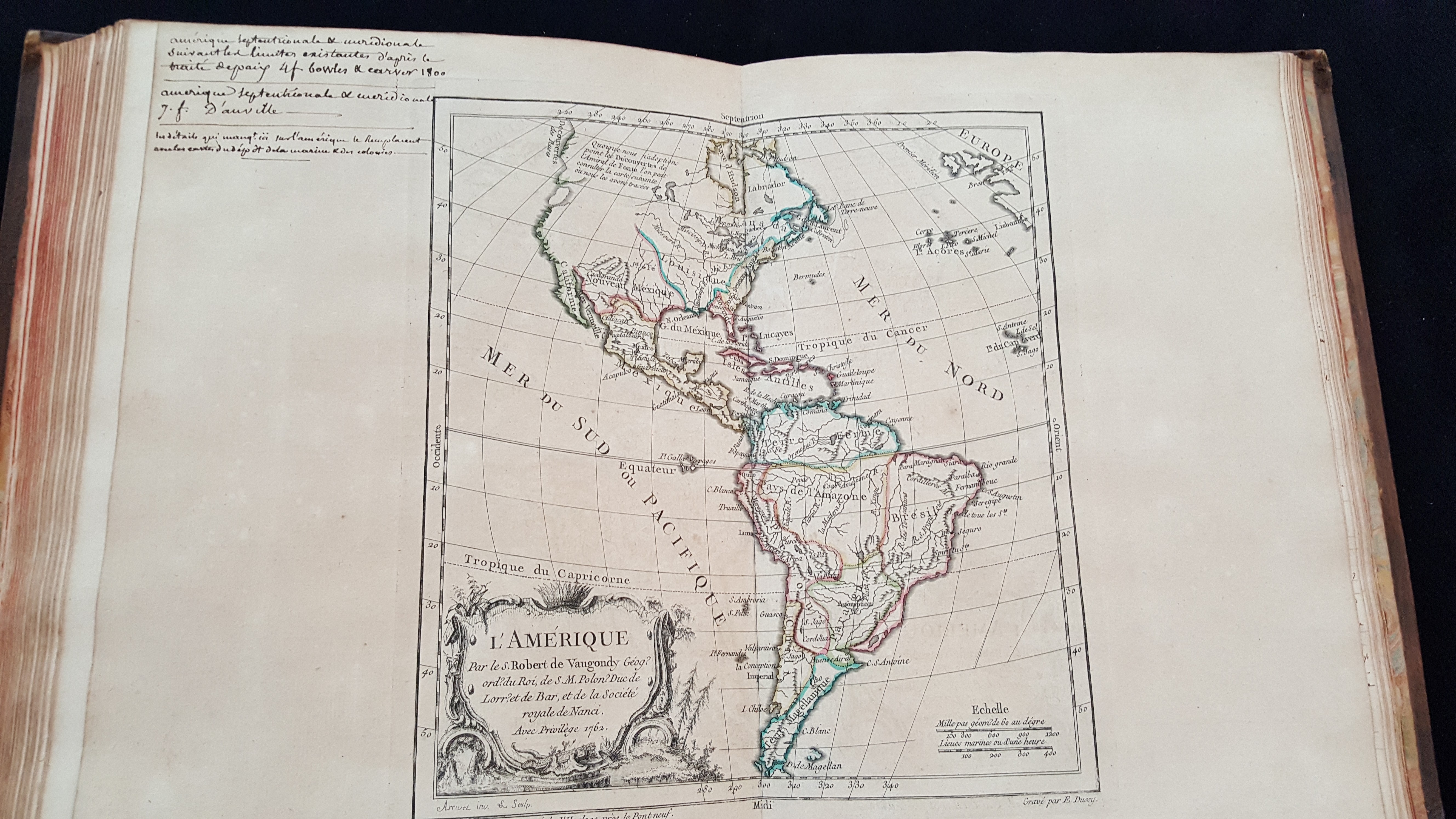
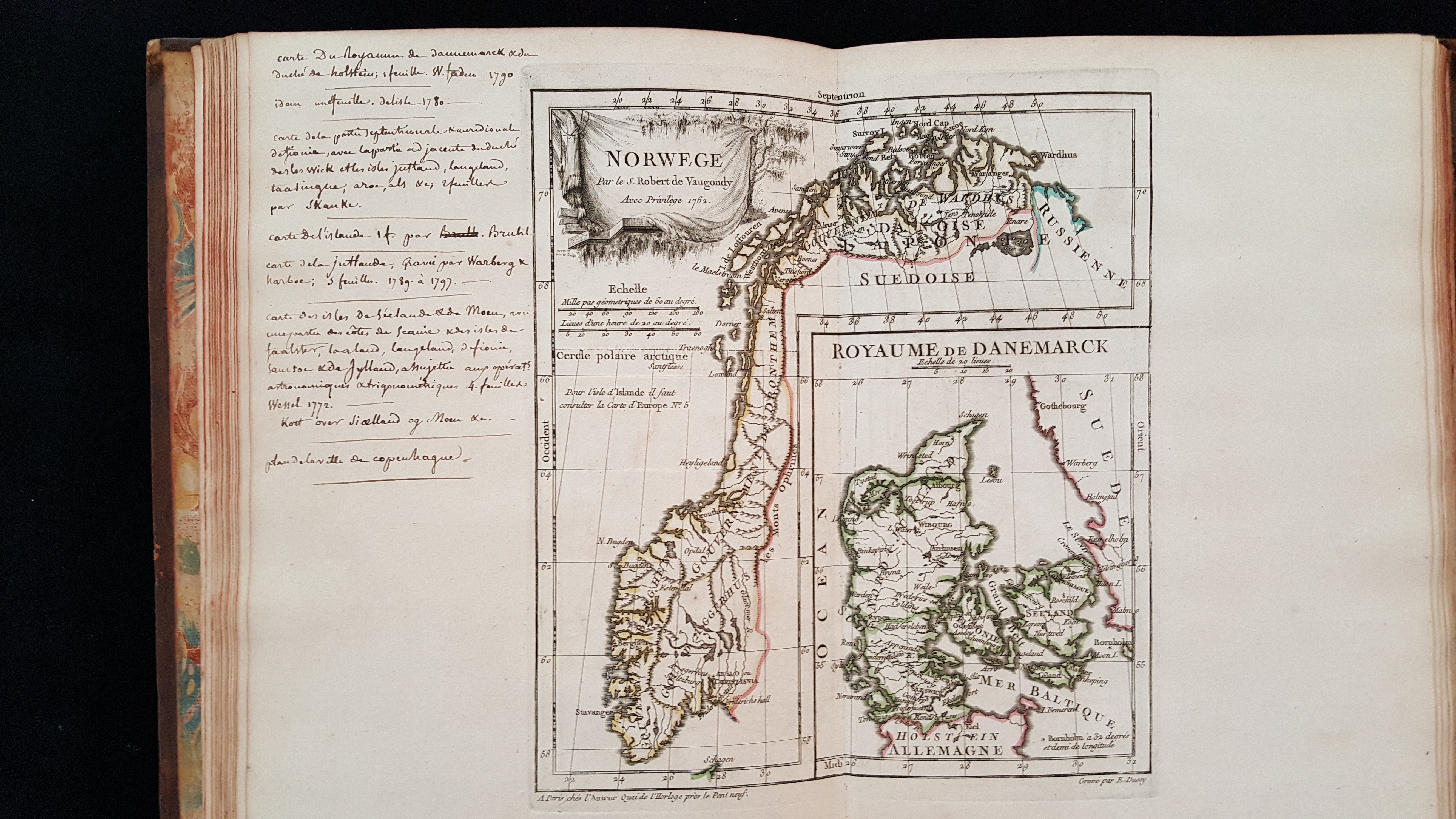
Didier Robert de Vaugondy (1723–1786), appointed geographer of King Louis XV in 1760, created this atlas to educate young students in the basic elements of geography. With his father, Gilles Robert de Vaugondy (1688–1766), he published one of the key atlases of the century called The Atlas Universel (1757) which employed modern surveyed maps to update and correct latitude and longitude points and revise place names. This 1762 atlas, consisting of 53 engraved maps outlined with color borders, includes four world maps (one detailing the routes of explorers, including the famous Captain Cook): five related to the Americas, three of Africa, five of Asia, four of the Holy Land, and the rest of Europe. Several later editions were created from this rare 1762 publication. This copy, once owned by the Hewitt sisters, includes numerous handwritten notations.
A mid-18th century full leather binding. The leather is in poor condition. The hinges are cracked and the endcaps damaged. Conservators will re-enforce the gutters. An acid-free custom enclosure will be created to house this fragile item.
Discover more about this book in our Catalog.
Adoption Type: Preserve for the Future