Map of Lower California

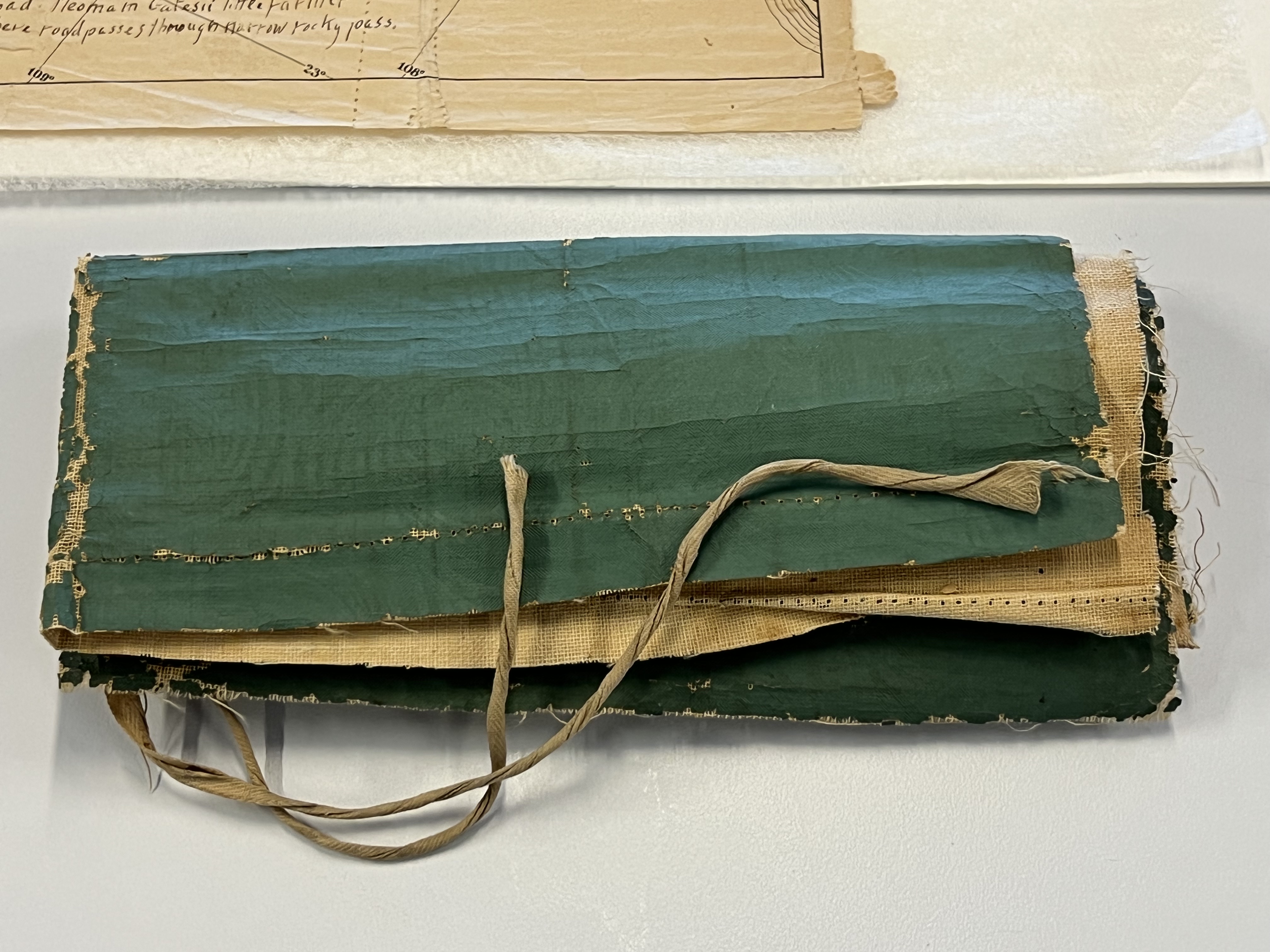
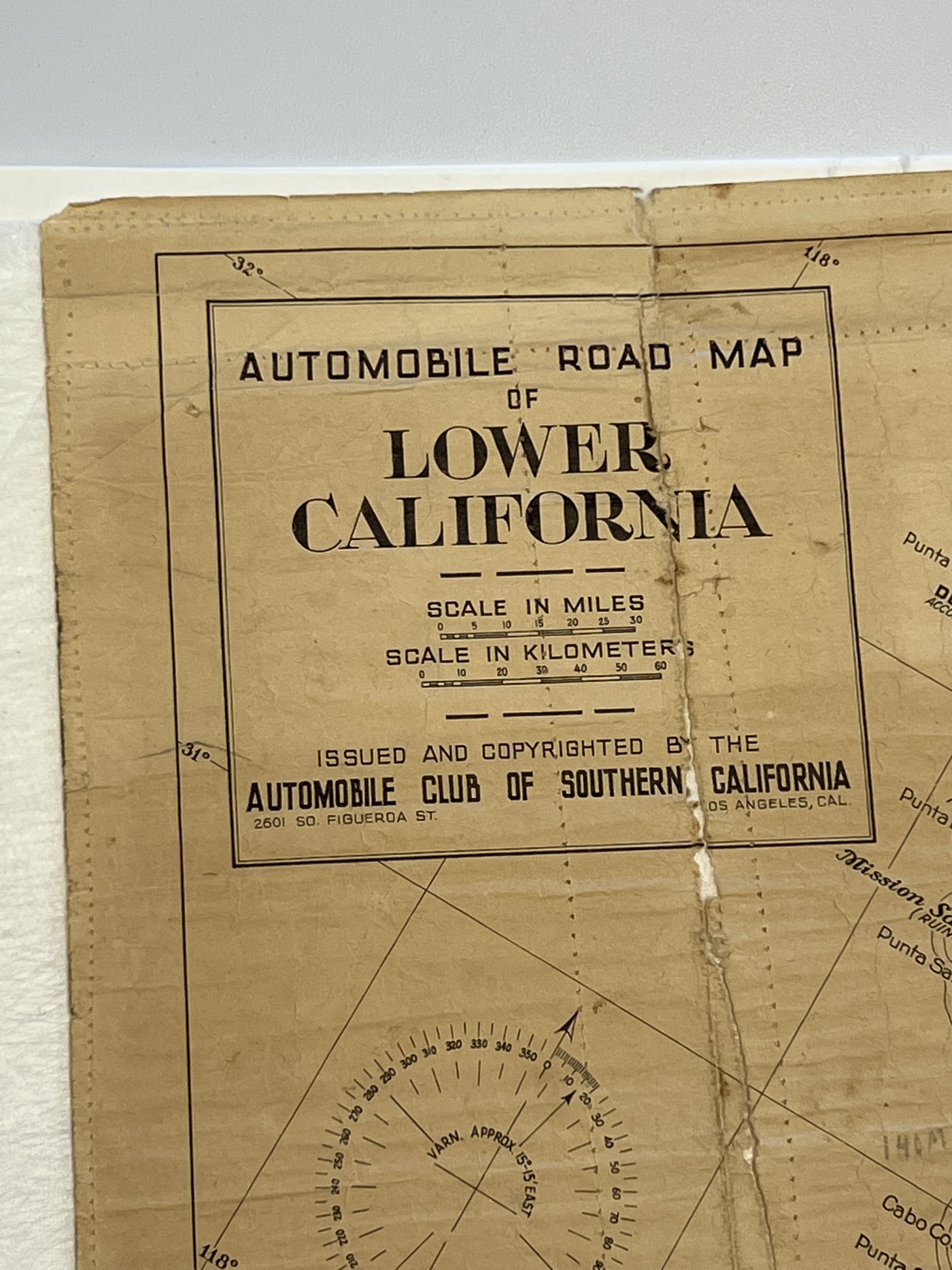
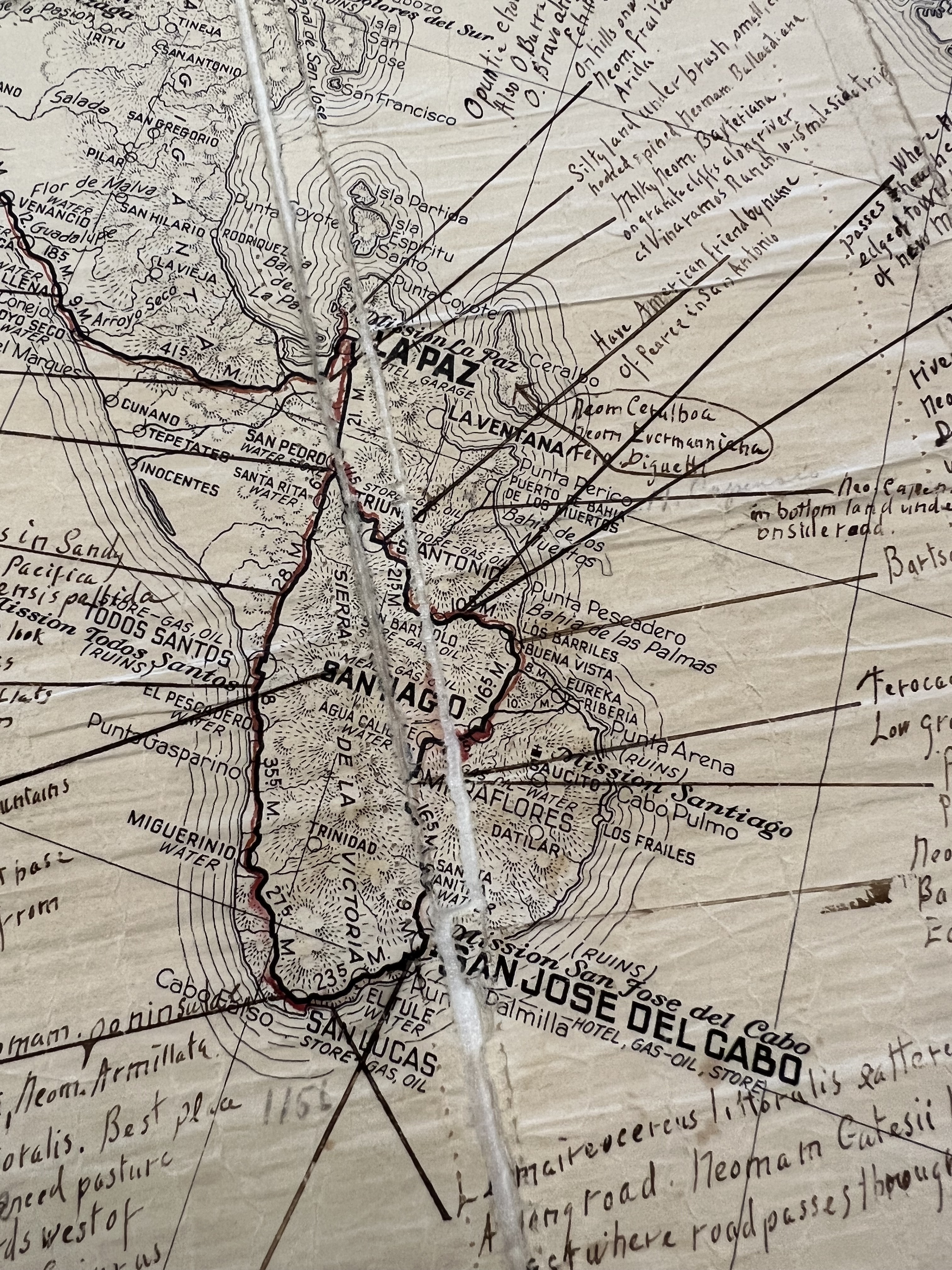
Map of Lower California with traced route and notes on locations of specimens, date of expedition unknown
This document is an early 20th-century road map of Baja California published by the Automobile Club of Southern California, one of the constituent groups of the American Automobile Association (AAA). Smithsonian botanist E. Yale Dawson (1918–1966) used the map to notate locations of collected cacti specimens on a field expedition, with careful annotations scattered across the document along the expedition’s route, marked in red. Dawson later reinforced and protected the map by adding a textile lining and waterproof cover with ties to keep the rolled assemblage together. This was inexpertly done with a sewing machine, and the intervening years have seen the map deteriorate.
Discover more about the map in this collection.
Over the years the paper and textile have expanded and contracted differently, leading to tears along the machine sewing, which make the map difficult to read and impossible to image properly. Conservation will separate and retain all of the map's components. Following humidification and flattening of the paper, torn edges will be aligned, and the entire map lined with Japanese paper. A custom enclosure is also planned that will include all original elements and communicate their previous attachment and state using layered storage.